Hydrography
INTRODUCTION
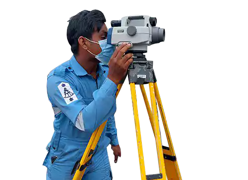
Hydrography is a science that measures and describes the physical features of bodies of water and the land area adjacent to those bodies of water, for the primary purpose of safe navigation, and other proposes include maritime defence, maritime boundary delimitation, marine construction, dredging, offshore oil exploration, and related activities.
HISTORY
The Navy's hydrographic activities go back to the Royal Ceylon Navy time. The British Royal Navy introduced the subject & continued on re-surveys in the early days, some of those data are still used in present day charts.
The first recorded survey by the Ceylon Navy was done in 1962/1963 when the Navy under took hydrographic surveys for the Pulmudai Mineral Sand Corporation using conventional means. The data collected was used for the nautical charting as well as for the construction of the pier and approaches to it. In 1967 Navy started to send officers for the Basic Hydrographic course in Indian National Hydrographic School, which was at Cochin at that time. The Naval Hydrographic Branch was established on 19th January 1970, and the first officer to head it was then Lieutenant Justin Jayasooriya, who later rose to become the Chief of Staff.
The Naval Hydrographic Branch was involved heavily in delineation of the maritime boundary between India & Sri Lanka in 1972 and some of those technical issues observed by the Indian Hydrographers (Head by then Commander Frazer of the Navy) were later used in making the 1982 UNCLOS & subsequent TALOS.
On 13th March 1984, as a national effort, the National Hydrographic Office (NHO) was established under the National Aquatic Resources Agencies (NARA) with the Navy's hydrographic equipment, and the Navy as a partner to head the Operational branch.
Today, the Navy had re-activated the hydrographic capabilities in an integrated approach, which will be beneficial to the nation. The Navy intends to extend its expertise to institutions like universities, Telecom & Petroleum Corporation thus pooling the resources for better productivity
-
Update national charting scheme
-
Production of new coastal charts
-
Strengthening bilateral and multilateral relationships with international hydrographic community
-
Production of electronic navigational charts (ENC)
-
Establishment of marine spatial data infrastructure (MSDI)
-
Development of necessary infrastructure for marine safety information
-
Tide monitoring for re-establishment of mean sea level (MSI) around Sri Lanka
-
Lectures and practical conducting for universities on hydrography aspects
The objectives are carefully set hereunder in order to achieve the vision stipulated herein, and to ensure specifically that international obligations under SOLAS (Safety of Life at Sea) convention are met. Further, it is also envisaged that current and potential future military tasks and related national requirements are supported by high-quality hydrographic and geo-spatial information, products and services. They also help SLNHS to deliver value to all its stakeholders in the products and services it provides, with its resources and capabilities.
-
To Provide Operational Support to Sri Lanka Navy and other Defence Organizations.
-
To Provide Assistance achieving SOLAS Obligations.
-
To Provide Assistance for National Requirements.
-
To Formulate Professional Workforce in the Discipline of Hydrography.
-
To Achieve Organizational Excellence.
In delivering the above objectives, the SLNHS will demonstrate organizational excellence by:
-
Conducting its operations jointly with NARA to the recognized international standards required by IHO, defence, other customers and regulators;
-
Ensuring all obligations, contractual or otherwise, to its stakeholders are met in accordance with national/ international requirements;
-
Creating a working environment that fosters enthusiasm, leadership, personal development, innovation and team working;
-
Delivering its services efficiently and effectively towards customer satisfaction, thus ensuring that all expenditure and investment that put into represents good value-for-money for defence, thereby making it a centre of excellence.
-
The SLNHS will provide value to defence establishments of Sri Lanka by delivering the hydrographic services, which enables Sri Lanka Navy, Department of Sri Lanka Coastguard and other defence organizations to undertake current and potential future operational tasks in times of peace, crisis including emergencies or war.
Having jointly administered the NHO of Sri Lanka, the SLNHS will take appropriate actions to satisfy international obligations under SOLAS convention assuring safe passage for the vessels and other marine activities in Sri Lanka’s waters.
Having equipped with state of the art equipment, technologies and professional human resources, the SLNHS will continue to provide assistance to stakeholder governmental institutions/organizations to meet national demands.
To be succeeded in achieving the vision, it is mandatory that the SLNHS to be strengthened with professional workforce that could deliver required results in accordance with international standards stipulated by the International Hydrographic Organization (IHO).
SPECIAL NOTE
On 13 Jan 23, by the Extraordinary Gazette number 2314/79 HE the President ordered members of the Sri Lanka Navy, specialized in Hydrography and Nautical Cartography to perform hydrographic activities at National Level considering National requirement.


